As drones get cheaper, is it time to start your own in-house drone program?
Below are some things to consider from our experience working with a wide range of clients, which we hope will help you determine the best approach for you.
Aerial Photography or Drone Data?
The first consideration is whether you are just using the drone as an aerial camera, to take some photos and video of your projects or have a quick look at things. In this case as long as you’re flying safely and are compliant with the rules, it probably makes a lot of sense to do this yourself, and something like a Mavic 2 Pro will do a great job.
If you’re aiming to create data from the drone though it quickly gets a lot more complicated, and for many people that’s where it can start to fall into the “too hard basket”. Drone data is a very specialised area and involves a lot of other software, equipment and knowledge, the drone itself is just the starting point.
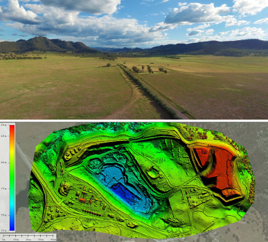
As a simple example, if you wanted to create some aerial panoramas over a location such as this (perhaps to help people with site familiarisation or planning), you need two pieces of software to make that from the drone images, and also a server to host that data on. So although it is a quite simple format compared to things like a Digital Elevation Model (DEM) or 3D point cloud, it still requires some specialist tools to produce, not just the drone itself.
Have a Drone Team, Not Just a Drone Person
When planning an internal drone program, consider how many people you will get trained up and licensed, so you can keep it running.
Usually one person is initially driving the idea, but if you’re serious about building a long-standing capability within your organisation you’ll want at least a small team. It is common for the drone person to leave the company or get tied down with another project for a while, leaving a gap in the service and knowledge.
By having a few people on the team you can cover for this and general staff turnover. You want to be sure there is always at least one person who is fully trained, with recent flying experience who knows all the rules, to avoid starting from scratch each time someone new wants to pick it up. Think of it in the same way as any other technical activity in your business which has some risk associated, you wouldn’t want people to just “give it a go”, they should be part of an ongoing training and support program to ensure a safe and successful result.
Set an Annual Budget, Not Just Purchase Price
Drones are evolving faster than other technology in your business such as IT or mobile devices, so it is best to think of the equipment cost in terms of an annual budget, not just the initial purchase price. It is common to depreciate and replace on a 12-24 month cycle.
The budget should also encompass things like staff training, licensing, compliance and insurance as well as the equipment itself, and be sure to at least include some additional batteries and a rugged hard-case to protect it all in the field.
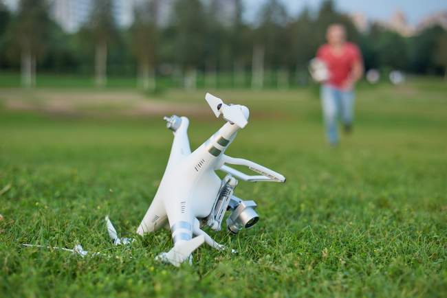
Unfortunately repairs can become a considerable line item too. Unless you already have quite experienced pilots we’d recommend allocating 30% of the initial purchase price in repairs each year, so if you hit a tree or get attacked by a bird that is already budgeted for. Even if you don’t have any accidents you still need to cover the expendables such as batteries, propellers, memory cards, etc.
Insurance
Be sure to check with your insurers or internal insurance team how your drone operations will be covered.
Business liability insurance usually excludes aviation, and as silly as it may seem drones come under the federal aviation regulations so unless you already have a specific policy covering aviation (e.g. for charter or fly-in-fly-out) then it is likely you will need some additional coverage.
The insurance premiums are generally pretty affordable, so the cost isn’t the problem, but be sure you go through the proper process or you are exposing the company to quite a lot of risk. Drones are usually pretty harmless but insurance is there for the “what if” scenarios, and it is quite easy to imagine some very costly ones so make sure you’re covered.
In the past insurers have been more open to covering against drone equipment loss, but it is getting a lot harder these days unless you have a track record. So for the first years of your flying you might need to accept that the equipment itself won’t be insured for loss or damage, only liability.
Licensing and Compliance
There are 3 basic approaches to drone licensing in Australia:
- Remote Operator Certificate (ReOC): this allows a company to operate a range of drones, anywhere in the country, including the ability to apply for special access permits for restricted locations. Any serious drone program will need a ReOC to be able to operate freely without too many restrictions, and is likely to be insisted upon at larger companies from a risk management perspective.
- Remote Pilot License (RePL): the individual pilots operating within a company holding a ReOC also need their own licenses. These are quite easy to obtain and there are many training organisations offering these courses.
- ‘Sub 2kg’ unlicensed category: in 2016 CASA amended the regulations to allow very small drones to be operated commercially without the above licenses. There are a lot of restrictions on this though (which a lot of people seem to conveniently overlook) and this is currently being reassessed after a senate review. The likely outcome is that unlicensed operations will still remain possible, but with drone registration and a basic training and accreditation program around the risks and restrictions.
You should ensure you are aware of the rules and limitations for the license category you are operating in, and also other related regulations such as privacy and OH&S. There are also requirements around things like record keeping, equipment servicing and reporting of incidents, so it is best to have processes in place to ensure this is all handled in a timely and systematic way.
Data, Backup and Security
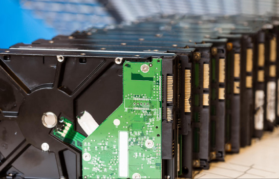
Drones are so valuable because they can gather a lot of data very quickly, but keep in mind that data needs to go somewhere, so you need a storage solution and also a way to view or analyse and share between the relevant stakeholders.
If it is just some photos for inclusion with a project report or a promo video then it’s not too much of a problem. However, if you’re doing something like monthly progress flyovers or asset inspections you need a way of managing all that data so it is available for review and comparisons over time, including appropriate backups, and in the case of sensitive data ensuring only the right people have permissions to access it.
If you’re at a larger company, talk with your IT department about where to store this data and how much of it there will be. To put things in perspective, a single flight recording 4K video will use more storage than all the emails you’ve ever sent, so you can’t just stick it somewhere and hope nobody will notice, it will need to be properly managed.
If you’re at a smaller company consider something like a NAS storage device which will get you a lot of space quite cheaply and is also robust against drive failures if set up in a RAID configuration. If the data is quite valuable you’d also want to have an off-site or cloud backup in case of fire, theft, etc.
Drone Data: The Big Differentiator
As mentioned at the top, if all you need to do is take some aerial photos and video then that’s quite straightforward these days, even the kid next door can probably do a decent job.
However, if you want to produce accurate survey data, stockpile volumes, 3D models or large inspection datasets then that is quite a different ballgame. That’s not to say it isn’t possible, but there is suddenly a lot more gear and things to learn if you’re going to get into this specialist area. So unless it aligns well with their core business (e.g. surveyors), most people will quickly lose their appetite when they find out what is involved, they just want to fly drones, not wrangle all the data through a half dozen steps.
For example, with a typical aerial survey project we might spend 2 hours on site, but then 10+ hours dealing with the data back in the office, moving it through various software packages that we’ve spent quite a bit of time training on. We will have spent $4k on the drone kit to do that job, but over $100k on survey gear, processing computers, software, online data hosting, backups, etc.
The other major challenge for this kind of work is Quality Assurance. With aerial photography if it looks right, it is right. Unfortunately though, with survey or 3D data unless you’ve gone through a careful QA process you can’t be sure that the final data is accurate, which can lead to some expensive mistakes if others use it to design or measure from.
Which brings us back to the insurance topic. You’ll want to be sure your Professional Indemnity will cover you to deal with this, as they usually want to know the specific activities involved. This is the thing which keeps us awake at night at AUAV, even though we have a very comprehensive QC process, have been doing it for 6+ years and been externally certified by a number of different quality auditing organisations. When we’re supplying data for our clients to design and construct projects with budgets in the hundreds of millions, we need to be sure the data is right.
That is why we can’t rely on outsourcing the processing or just running it online and hoping for the best, you need to be closely involved with the whole process in order to stand by the results.
Summary
Hopefully this article helps you decide which is the best option for you. Keep in mind it doesn’t have to be an all or nothing situation, a mixed approach often works best. Nobody hires an electrician to change their light bulbs, but most will get one in to rewire a house.
Many of our clients get great results doing their own aerial photography work, but call us in for the more challenging or data-focused projects. By having a dedicated service provider on call, they can also advise and help keep you up to date with the technology as it continues moving ahead. AUAV is always happy to advise on the feasibility of drones for any specific project or situation, and we’re the first to say when it isn’t the right fit.
Drones are an amazing technology, helping to keep people out of harm’s way and to more efficiently gather great mapping and inspection data, but it is a specialist area and it helps to at least be aware of some of the complexities before jumping in yourself. Remember, flying the drone is the easy part!
If you want to discuss any of this or have AUAV consult on your own drone programs, please get in touch.
